Custom Map Design
Bay-Lake Regional Planning Commission provides custom map designs and printing services for communities within the Bay-Lake region. We work directly with communities who want to update old and outdated maps or want new maps created. Some of the Commission’s published maps can be view below.
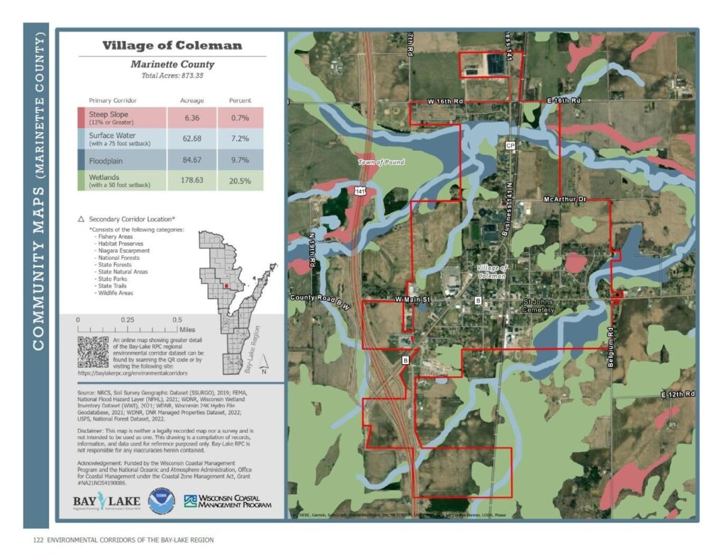
Environmental Corridors Community Map Series
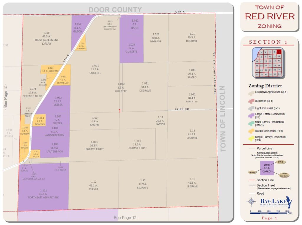
Town of Red River, Kewaunee County, Plat Book
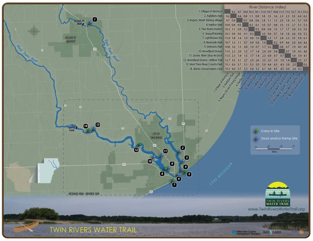
Twin Rivers Water Trail, Manitowoc County
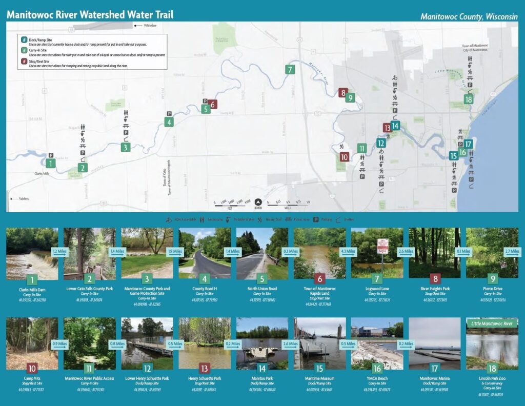
Manitowoc River Watershed Trail Brochure
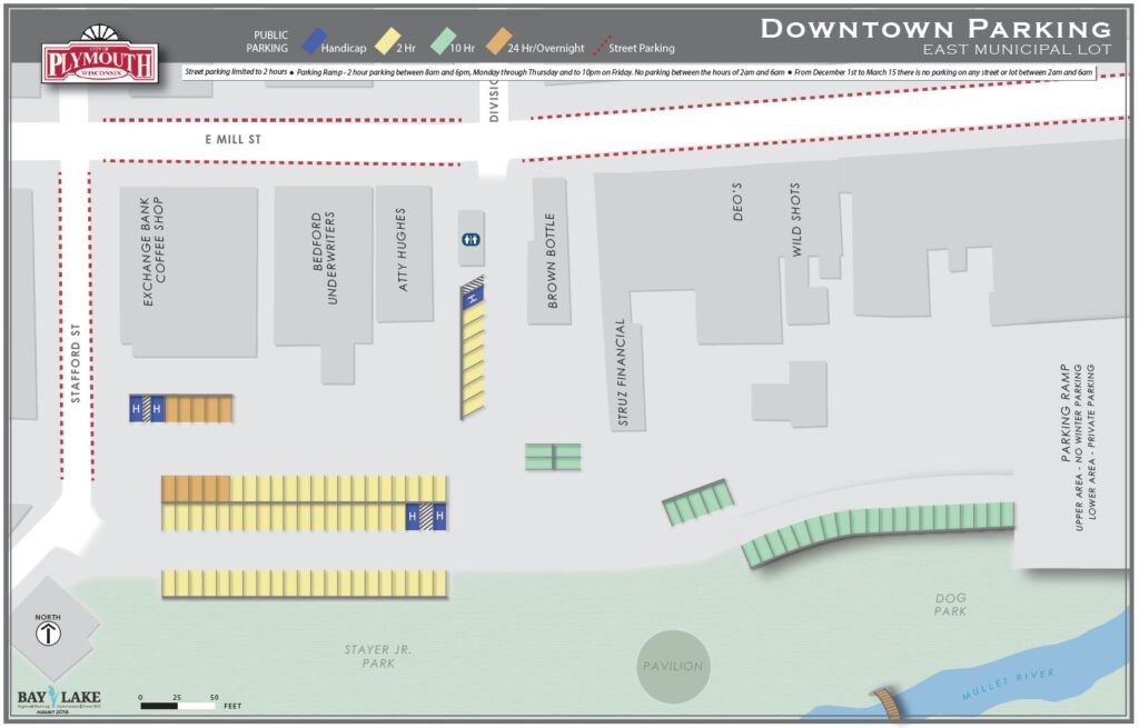
City of Plymouth, Sheboygan County, Downtown Parking
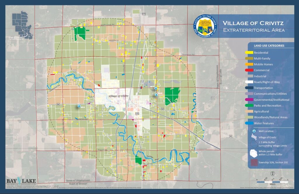
Village of Crivitz, Marinette County, Extraterritorial Area
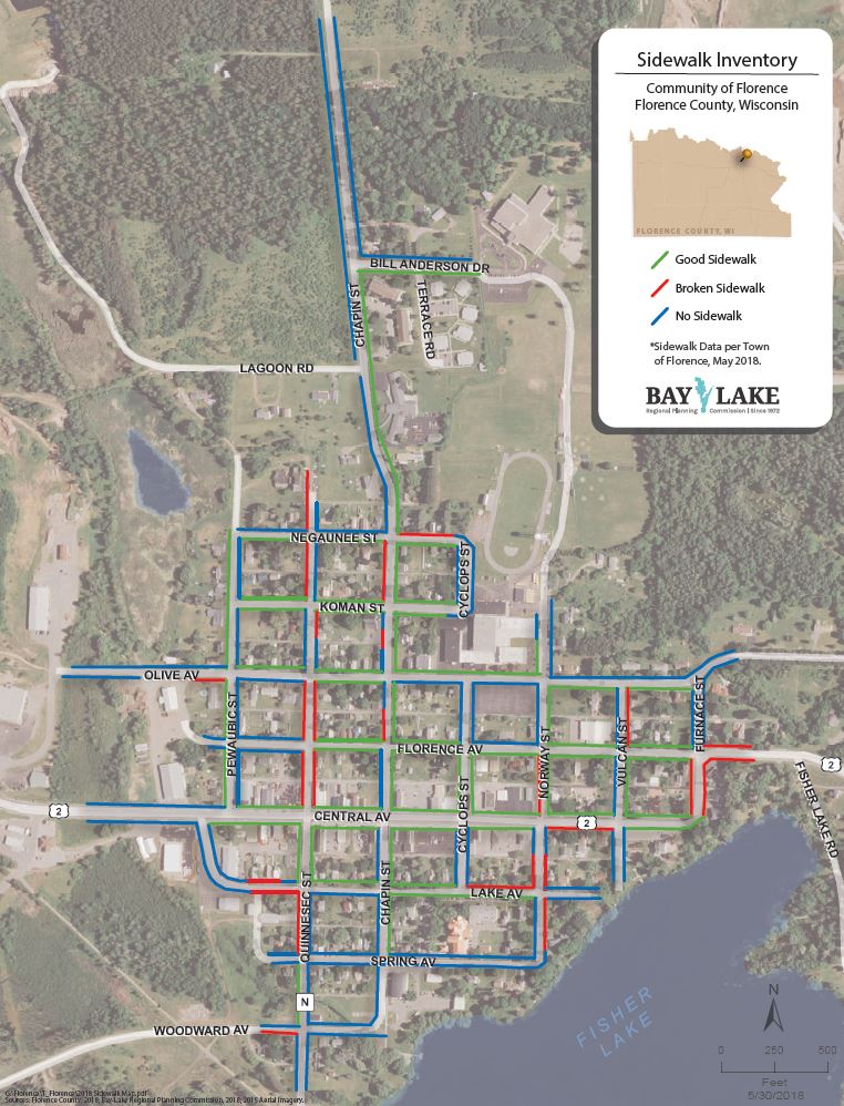
Town of Florence, Florence County, Sidewalk Conditions
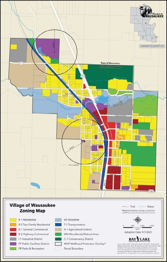
Village of Wausaukee, Marinette County, Zoning Map
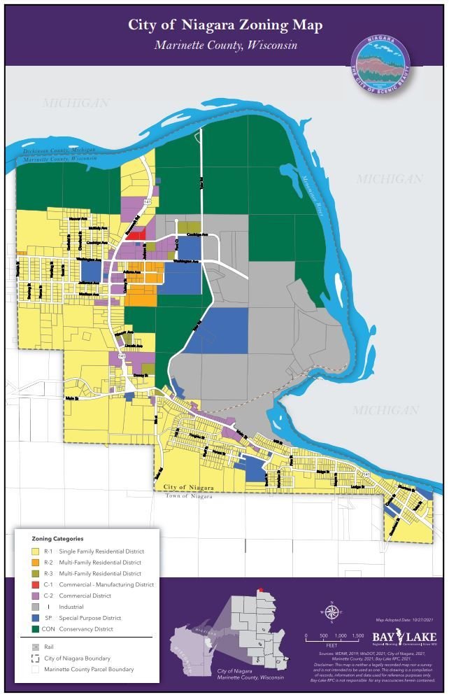
City of Niagara, Marinette County, Zoning Map
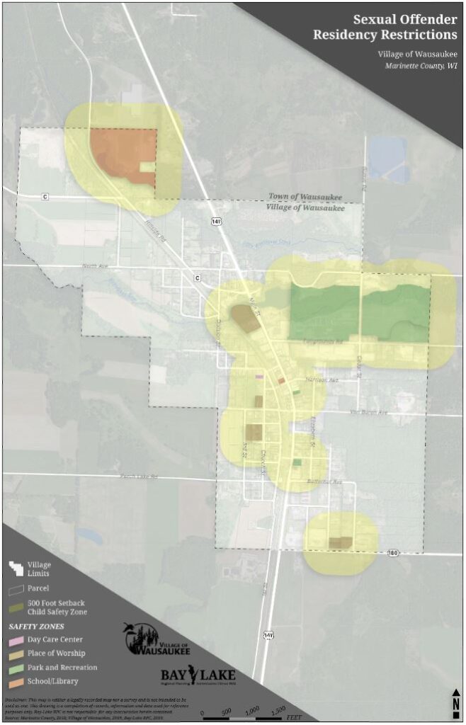
Village of Wausaukee, Marinette County, Offender Restrictions

